Thursday, January 10, 2013
Leg 20 – Topsy Grade in the Klamath River canyon.
Here we go again. Finally coordinated and planned to get out and resume our march to the Pacific Ocean. Dwane and I both developed a 4 day weekend off plan and he came down Thursday night so we could head south on Friday morning and take on the Klamath to I-5 section. I prepared the mini-bikes in the week or two before and was anxious to try out the new torque converter belt drive I’d installed on mine. I bought an adapter and this snowmobile type belt drive off the internet and had installed it 6 months ago. I tested it out with my son Daniel this last summer by riding up the jeep trail to the top of Cultus Butte in central Oregon near little Cultus Lake. Seemed to provide much greater pulling power, which I need more than Dwane, at slower speeds and a higher top speed. The first time I tried out the modified mini-bike at home I pulled a wheelie.
Our plan was to drive down I-5 and cross the border at Hilt and attack the Klamath River to I-5 section from the CA side of the border. This was necessary due to the National Monument and wilderness designation of about half the border land to the north in Oregon in this section. The Soda Mountain Wilderness was established a few years ago and as part of that change the roads, of which there are many in the area on the north side of the line, were closed. So we headed south on I-5 in my new-used pickup pulling our little trailer and the mini-bikes to the Holbrook exit just south of the border crossing near Hilt. We pulled off the freeway at the border to reconnoiter the Hilt area at a wide spot downhill from the Siskiyou summit. The GPS indicates, and our maps confirm, that I-5 is about mid-way between mile points 30 and 31. We may run into private property issues, but it appears there are several nearly parallel routes for the first few miles west from I-5 when we attack this segment. We continued through Holbrook to the east and along the north bank of the Klamath River.
There are two reservoirs along the Klamath River south and west of where we last hiked down into the canyon (Leg 14) from mile point 104 and we planned to drive the north side of the lakes. Copco Reservoir is the upriver reservoir to the east and Iron Gate reservoir is down river and hence the first one you encounter when driving up the river from I-5. We were hoping to confirm some of the roads leading north from these two reservoirs to the border that we could use as access points. Our plan would be to drop our bikes and take the pickup further east before hiking back to the bikes. We’ve found that taking on 5-6 mile segments in this manner actually working east, but hiking west by leap-frogging with the truck and bikes works best. Unfortunately, we didn’t find the two or three roads leading north from the reservoirs we were watching for to be usable. Most were posted and gated. We may need to contact the Pacific Corps, which operates the two reservoirs and has purchased thousands of acres of lands in this area, to gain access. We continued on to the Topsy Grade Road and the area we’d last visited and hiked out of in the middle of the night during Leg 14.
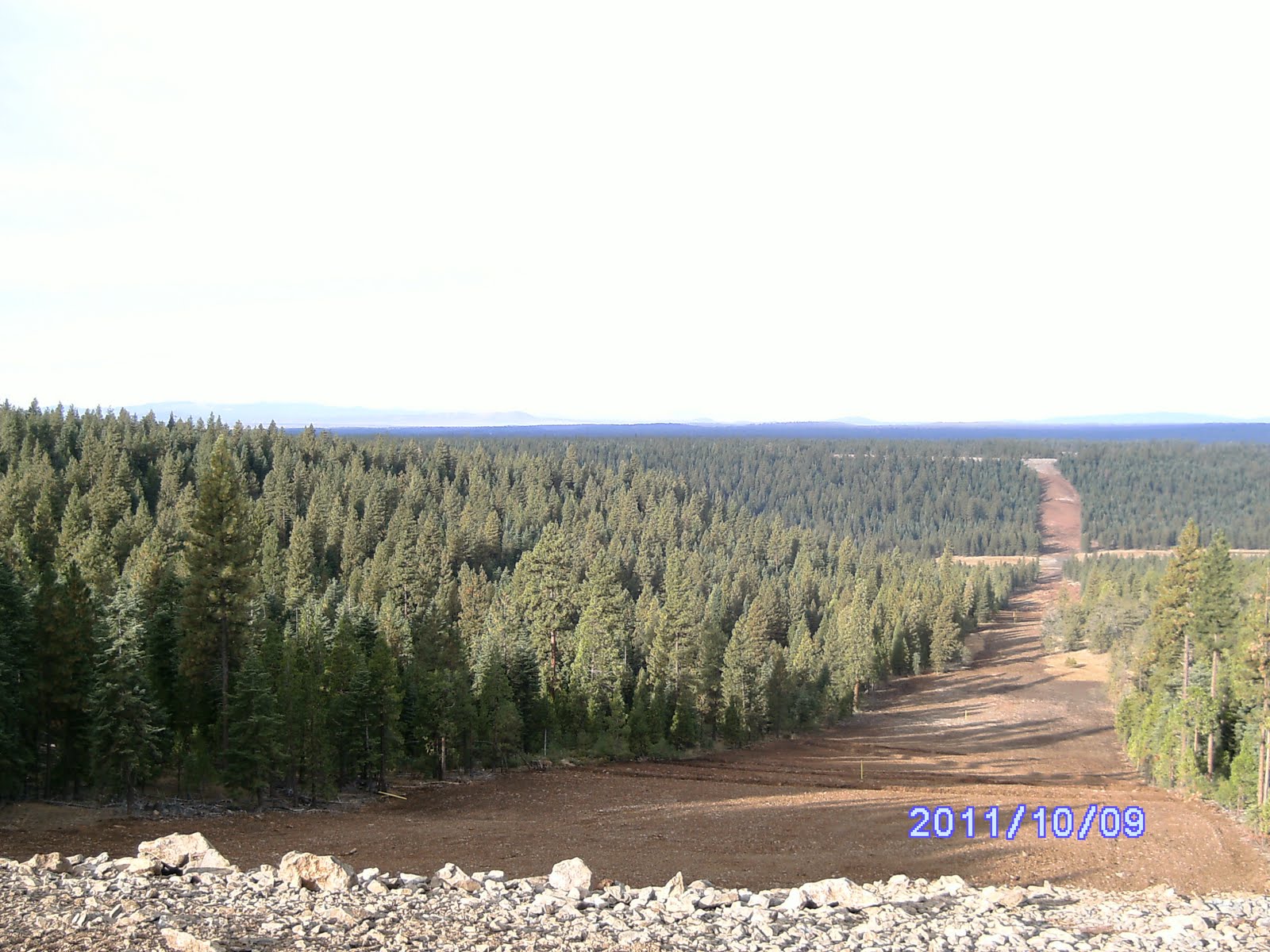
This picture is at about MP 108 looking back west down the river valley.
We found the point at which we dropped on to the Topsy Grade Rd, near mile point 105 and found a road leading south to the base of the steep canyon wall. We launched out to pick up MP 106, dating from 1982 and pictured below, and ended up climbing halfway up the slope before figuring out there was something not functioning properly on my GPS and starting back down the slope.
Ultimately, Dwane found it by following a survey line we had not noticed when heading up the hill. My new-used hand-me-down Magellan seems to take several minutes to hone in on our exact location precisely which is significantly different from my previous Magellan.
The hike to the west towards an anticipated river crossing was fairly easy through a pretty mature forest that broke into an oak forest. We found 106 thru 109 in fairly short order just as they were stored in my GPS as waypoints.
Someone has erected their own piece of heaven between 106 and 107. We gingerly and quietly bypassed a nice cabin. MP 109 and 108 were along the canyon several hundred feet above the river as the Klamath swings east-west at this point.
We found the historic bridge and ford site near MP 109 at a slow bend in the river and canyon. It’s a designated park site. This picture is looking down at the river from above MP 109.
We’d hoped, based on looking at satellite pictures and maps, that this point would be crossable on foot or with the truck. Unfortunately for us, the water was running very high. In order to maintain flows for the salmon now coming up river from the Pacific and being pursued by the hundreds of fishermen we’d passed below the reservoirs early in the day, Pacific Corps was dumping a lot of water from upstream reservoirs. These dams are destined to be removed in the coming years under a massive, multi-agency environmental project underway in the Klamath Basin.
At this old bridge site we were in an oak forest and we noted the thousands of acorns strewn across the landscape and began a conversation that lasted the whole weekend trying to think of a commercial use for them. We couldn’t come up with what seemed like a reasonable way to utilize them other than raising squirrels, to what end we weren’t sure, but the debate continues. We’re open to any ideas because we know where a few tons could be had fairly easily.
After walking back up the road to the truck we were pushing daylight, so we headed back up the canyon again in the dark as we had on foot months before. At the top of Topsy Grade near the historic stage stop site overlooking the canyon we headed back south to pop out on Hwy 97 at Dorris. We took a drive around town, but nothing that was open really appealed to us as a possible dinner site. From Dorris we headed north to Klamath Falls and our favorite place to stay – the Comfort Inn on the south end of town.
Leg 21: Grizzly Flat
Saturday morning, we saddled up, enjoyed the breakfast at the comfort Inn and then endeavored to head west on Green Springs Highway. We planned to find attack points from the north of the border and river east of the wilderness area. What a confusing area this turned out to be. After several hours, including a few tense minutes talking in turn with several local ranchers each insisting we were trespassing and needed to basically get the hell off their land, we found a road that took us to near MP 118 and Jenny Creek which runs south into the Klamath. We parked surreptitiously in the forest and headed out quietly into the ranchlands to the east along the state line and quietly reached MP 117 and then backtracked to catch MP 118 on the way back west to the truck.
We saddled up and endeavored to find a way to get down to the river further east and near the crossing point but wandered for hours among the maize of old timber roads and even railroad grades without success. In the middle of one of countless quick stops and back up to check an intersecting road I lost track of my small trailer and promptly “customized” my rear fender as I jackknifed it into my truck. Oh well. At one point we ended up on top of Grizzly Mt, view from below, which required slugging our way through several miles of brush clogged logging roads that took off a few pounds of paint from my truck.
As the day wore on we eventually bugged out back north to the Highway and headed back to the east and the Klamath River crossing at the upper Dam. A road system depicted on the map meanders down the north bank along the canyon wall. As it turns out it’s 17-18 miles of rough, rocky road full of kidney jarring holes and bumps. We passed several camp sites somewhat developed by Pacific Corps, although I can’t imagine many timid souls traversing the rough road to get to them despite their beauty in the rugged canyon.
We came on a flock of wild turkeys as we neared our objective across from MP 109 and now on the north side of the Klamath. Picture below.
As we neared the part of the canyon across the river from Topsy Grade Rd and our last mile point, # 109, we came upon an old ranch site now presumably owned by Pacific Corps and abandoned from its original purpose. The ranch is on a beautiful stepp above the river canyon with a large farmhouse and barn still standing. When we crept up to take a look at the site I forgot to bring along my camera. There’s even an abandoned 65 Malibu station wagon at the site and I contemplated removing the one piece of undamaged body side molding remaining. Ultimately, it would have taken some tools to remove the molding and we decided to get back to camp. Still had some daylight, so we headed out on the bikes to recon the area ahead of us above the canyon rim to the west. We had noticed a primitive road leading north up the canyon wall from where we had determined to camp for the night. So we saddled up.
We warmed up the bikes by taking them down to the river and back looking over the high water and debating if we should simulate crossing the river.
After getting back to the camp site we headed on up the side road we had noticed coming into the canyon from the north. After a mile or so of rocky switchbacks and rough steep lengths of “road” we reached the canyon rim and two traversing east-west power lines. We turned down the power line to the south which appeared to be the closest intercept to the point above the canyon from MP 110. We hit the canyon overlook after a mile or two of riding as the daylight was fading. Got some pictures of the canyon looking east including of the ranch area immediately below us and where we were presently camping for the night. We knew we were close to MP 110, but the recon pretty much confirmed it was just below the rim cliffs and probably unreachable without a hazardous climb east of the ranch through the no trespassing posted area. We headed back down the road in the dark and Dwane managed a face plant in the dark as his front wheel caught a rut in the road. These dang things are really maneuverable but that also makes them prevalent to taking off in a different direction of their own choosing. I noticed he had lagged behind me in the dark although I could still see his light. I paused assuming maybe he thought I had taken off on the wrong branch, but realized when I saw his dirt caked face illuminated in my headlight that he had encountered a problem. Nothing broken, so we continued back down into the canyon in the dark riding our brakes and basically skidding down these cat trails with our rear wheel functioning as an anchor. The hot ramen at camp lightened our spirits as we plotted the attack for the next day and laid out our bags in the back of the truck. We don’t have my newer truck equipped to carry our large, tradesmen style canopy, but it came with a fairly high fiberglass canopy. I have an army cot that fits along one side of the pickup bed and Dwane can stretch out on the floor. It was a pretty restful night, all things considered.
Leg 22 – Grizzly Flat Continued
In the morning we re-loaded the bikes on the trailer and started the long slow climb in four wheel drive up the cat trails leading to the power lines above us. Our Camp near the abandoned ranch:
We drove on down to the spur we’d found the night before in the dark and walked along the rim until intersecting the state line near a shack that had been built on the edge of the canyon. It overlooks mile point 110 at the base of the cliff and was likely abandoned as part of the lands Pacific Corps has acquired. Got the pic below the next day – 110 is at the base of the tall trees, middle frame.
Little piece of heaven, in deed! It was certainly rustic, but would have been comfortable and dry with a view to kill for.
After exploring and capturing some pics we got in the truck and headed back down the power line angling towards the border until coming upon No Trespassing signs and loose barb wire stretched across the power line right of way.
We figured it wasn’t likely we’d get a good reception if we jumped on the bikes and didn’t want to get lost trying to find a way round through the maze of logging roads to the north, so we dismounted. We locked up the truck and bikes, loaded up our day packs with water, and started west to find MP 111. Since we didn’t have any real alternatives, we braced up for a long walk to and back from MP 116. The territory is rolling hills of oak savannah with little rocky buttes, lots of dry grass, and the occasional brushy spots. Came on some pretty knarley looking oaks, a few ridges with rocky rims and grassy slopes.
Being fairly warm and dry we were on the watch for snakes, but only had one such encounter on top of the rocky butte Dwane is on top of here.
.
I had a point loaded in my GPS that should have been a monument on top of one of the rocky buttes on which we obtained a great view. Never did find the monument or anything else on top, but as I was looking among the rocky shelves I startled a rubber boa snake. The darn thing was as startled as I, but instead of going away from me it darted between my feet to scurry into the rocks below the small ledge I was on. Anyway, we endeavored on bagging MPs 112 through 116 in the fairly open terrain. Caught the picture below of a beautiful red headed woodpecker whooping it up in the mud holes around Wild Gal Springs, but it’s barely visible at center frame.
The pic above is MP 115. We made good time along the fence lines and strategized about whether to reverse route back along the border, or detour north or south and pick up the largely parallel power lines. As we headed back from 116 we decided to take the detour perhaps a half mile to the south and pick up the power line. Pretty uneventful except for a half dozen curious horses that skirted around us at the gallop and then fell in behind for a half mile or so of trailing us from a distance.
We made it back to the truck with some daylight left and headed north following the main roads intending to make it back to the highway and on to K Falls for the night. Breezed past several deer hunting camps as we navigated a little more successfully than the day before, although we did make one circuitous route selection ending up passing thru the same intersection a couple of times. We eventually found the right main road and popped out on to the highway and headed East.
Back in town and at our favorite Comfort Inn we headed to Denny’s and dinner. Unfortunately, our favorite road meal, meatloaf, wasn’t available, so we had the pot roast instead and plotted our next segment.
Leg 23: Malin
We decided to fill in one of our skipped segments in the morning and headed south and east of K Falls to Malin. We had skipped a 5 mile segment over a ridgeline from the Langell Valley west to Malin and the Klamath Valley at the end of Leg 13 and a long day. This picture is looking down at the point where we decided to give up late in the day on Leg 13 and head out to the road. We’d crossed the river and made it up to the base of the steep hillside along the pipeline before deciding that another 5 miles wasn’t going to be possible before darkness fell.
The newly installed natural gas line runs along nearly the whole segment never more than a quarter mile from the border, so it made for easy walking. While roaming around looking for a road to take east with the bikes we passed through a piece of property with a house literally next to the graveled road. It was a nicer house and the route wasn’t posted with No Trespassing signs so we simply slowed and proceeded by the house. We ended up coming back down this road after hitting a dead end and this time there were two men working on loading a vehicle near the house. We pulled up slowly and when the turned their attention to us I stopped and rolled down the window to talk. Had a brief conversation about what we were up to with the eldest guy, appeared to be father son duo to me, but we didn’t really introduce ourselves. The father had a pretty good sense of humor and wished us well on our sojourn after suggesting which road we should take to get east to pick up the border.
We found a road that parallels the border to the south and left the truck at a locked gate, with no signs, unloaded the bikes and headed east to the point already described overlooking the point we’d left off during leg 13. Before we took off on foot back to the truck about 4 miles west we decided to reconnoiter the gas line right of way with the bikes a little more to be sure we could use it as the route westward.
We climbed a couple of small hills on jeep trails with the bikes to get back around to the pipeline and I got the bright idea to try going up the cleared pipeline right of way on one of the steeper slopes. I figured with my modified bike I could pull the steep face of what was the highest ridge on the leg and get a good view of our route if I attacked it going diagonally up the slope. Dwane waited at the base of the hill and got to watch my plan’s weak point exposed from several hundred yards away. I was just getting to the steepest part of the slope perhaps 2/3 the way up the ridge when my bike lost traction and slipped out from underneath me. I bailed off trying to keep my balance and remain standing, but made two mistakes. First, I didn’t have the presence of mind to hit the kill switch on the bike, and second I stepped off the bike facing downhill. Well the bike laid over with the engine still revving and I nearly did a face plant as I fell prone into the dirt. I wasn’t carrying a lot of momentum, so I managed to sort of catch myself. After getting the bike turned off, checking it over, restarting and heading back down the hill we decided it was time to get to hiking and stashed the bikes in the brush. Dwane did say my spill looked pretty dramatic from his vantage point.
The route along the pipeline was a little bit up and down, but generally easy and we enjoyed the view to the south. To the south we could see Clear Lake in California. Neither of us was aware of such a large lake being so close to the border. We agreed it merited exploring on some future trip if the opportunity presented itself. The hike west was pretty uneventful given that for most of it we were walking along a 100 meter wide cleared swath across the ridges and trailing valleys. Made it back to the truck in just a couple of hours and headed back to get the bikes. We got close and walked around another locked gate to retrieve the bikes and load up before heading back to K Falls and on home.
All in all, I figure we drove over 700 miles and walked about 30 miles to get credit for 20 miles of state line and mile points. It appears, with 12 miles remaining to reach I-5, we’ll likely do the next westward segment in two parts. Haven’t figured out if we can ride our bikes down the rural highways to/from the Iron Gate Reservoir, so we may need to get someone to drop us off.
We may plan to do the Lakeview area gap during the winter, if the snows don’t get too deep in the next couple of weeks. We’ll see.
Thursday, January 5, 2012
Leg 19: Renner Lake valley
I was having fits with the GPS as we were driving that night and apparently left the darn thing on overnight. By morning the GPS had become a useless “brick” and would not initialize or load up. We were close to the pipeline right of way so we headed generally east and up hill crossing back and forth across the right of way till we got to the high ground we took these shots from. We could see the Malin hills we’ve yet to cross and even Mt Shasta to the SW. Beautiful forest and country side again. Looks like prime elk habitat and we found our way south to intersect the line and Corral Creek road at about 34 after some fun exploration. Found the bikes and prepared to leave the truck intending to ride the bikes east and down into the Renner Lake valley from its east end and then walk back to the truck. Didn’t have the GPS for help, but I had some Topo map prints and I could remember where the mile points were in the valley, so we felt confident. Heh heh!
These pics are looking back west from above where we slept. At this point the pipeline runs about mile north of the state line and this is from the hill west of Renner Lake.


 Here's where we unlodaded near MP 32 to take the bikes back east down into Renner Lake Valley.
Leg 19 - The Incident.
Wish I’d had the camera rolling as we prepped the bikes – I know I’d be a millionaire at Dwane‘s expense! The bikes seemed a little hard to get started and I discovered a new idiosyncrasy about them. Seems that if we choke them too much they don’t really flood, they end up with an extra load of fuel in the carb. Once it finally starts the engine will race like it’s full throttle until the excess fuel is consumed. I got my fired up and fortunately got a quick grip on the brake as it started to take off. Warmed it up for a minute and then shut it down to advise Dwane on getting his running when about the funniest damn thing so far happened. I was forming the words in my mouth to caution Dwane about starting his bike while standing beside it instead of setting on it and in better control when his engine came to life. I think I got “I wouldn’t start it” out just as his bike took off at full throttle with Dwane hanging on to one side of the handle bar. I started yelling “let it go” as it ran up the side of my pickup with him dragging along with it like a rag doll still instinctively trying to control it with one hand as the bike revved for perhaps 4-5 seconds that seemed like an afternoon. If I hadn’t been suddenly focusing on what materials I had to fashion splints out of I would have been laughing my ass off as he danced a couple of dosie does with the bike until being whipped sawed to the ground as the bike finally fell over and died. I honestly didn’t think he was going to get up for a moment. After a couple of minutes Dwane assessed that he probably hadn’t broken anything even though the trauma made him sick to his stomach as he lay there with initial shock setting in.
We took a break.
After Dwane was on his feet again and properly instructed on how not to start these bikes we saddled up and headed west. Had a great ride and after a half hour and perhaps 10 miles running along smooth dirt roads we found a steep forest road that took us down in to the Renner Lake valley.
Without the benefit of the GPS it took a while to get oriented on the valley floor. Beautiful little piece of heaven, that valley. The farm house is at the west end of the lake on a mini rim rock overlooking Renner Lake. Can’t imagine owning that kind of spread.
This is a lake south and a little east of Renner in ths same valley.
The left half of the far ridge line is west of Renner, which is just out of sight, and is the east slope of the hill from which the previous pipeline pics are taken.
We set out along the fence line from the east end of the valley and found 28 after taking a while to soak up the view.

We could occasionally see someone at the house in the distance as we worked our way west along the south end of the lake. Found some unusual rock formations as we approached the shallow SE finger of Renner Lake.
The shallow lake was very low, but still didn’t reveal mp 29 where I remembered it on the map. A mile further west and we were near the house, but didn’t find 30 which should have been right there. Our focus was to finding mp 31 just below the 100 foot cliffs that ring the valley along its west and south rims. We gambled we’d be able to find a way back up the cliffs and the remaining mile across the high plateau to the truck. No such luck. As we started up the forested slope to the west it became increasingly difficult navigating thru the thick Manzanita underbrush in the pine and fir forest. Without the GPS functioning we wondered back and forth thru the brush, up and down the slope trying to line up visually with the fence line and mile point 28 some 3 miles to the east and barely visible. This pic is looking back east from below the rim rock cliff across Renner Lake - Goose Lake is in the far valley and MP 28 is at the far brown field on the other side of the lake. You can see the heavy brush in the forground we were struggling thru.
Sadly, after an hour or so and determining the cliffs appeared to be too big of a challenge we decide the way we’d came was the better choice even late in the day. We trudged back eastward across the valley to the bikes and saddled up.
We headed up the road we used to get there, but there were some steep sections to navigate. I was concerned that my bike wouldn’t pull my fat 275 lbs up the hill, but found that with a full throttle and good run up I could make it up the several hundred yard stretches on the steep inclines.
Even though evening was coming on, we stopped to take in the late afternoon sun at one of the many meadows along the beautiful forest road. Made it back to the truck, loaded up, but decided to hike east to the rim rock cliff and see if we could find the line. We did as it was getting dark finding a section marker and sign at the top of the cliff overlooking the manzanita and forest we'd stalled in below several hours earlier. Got dark on us as we wondered a little in the forest to re-find our truck, but we did so without too much delay. We saddled up and headed back towards K Falls for a late dinner. At dinner over our meat loafs, a tradition on our road trips, we assessed our situation. We’d talked about leapfrogging to the west of the Klamath River and getting a segment done in the morning, but without the GPS and a good map recon of that area we figured we were asking for more trouble trying to navigate and find the mile points.
We decided just to get in the rig and head home. We headed out of K Falls at about 10:00, turning back to town because the discount gas station on the north end wasn’t open as hoped, and we rolled into Creswell about 1 in the morning.
Still haven’t figured out what’s up with my Magellan. Won’t initiate or talk to my lap top with or without the card in it. The factory guys are absolutely no help. Found several hints on line including the secret three finger reset of Select, Page and Power buttons simultaneously, but to no avail. Finally was told by the manufacturer to send it in for a small discount on a newer model. Damn thing is only a year and a half old! I think I’m switching to Garmin.
We tried to pull off an early Nov outing, but work forced a canceled 4 day outing.
These pics are looking back west from above where we slept. At this point the pipeline runs about mile north of the state line and this is from the hill west of Renner Lake.

 Here's where we unlodaded near MP 32 to take the bikes back east down into Renner Lake Valley.
Leg 19 - The Incident.
Wish I’d had the camera rolling as we prepped the bikes – I know I’d be a millionaire at Dwane‘s expense! The bikes seemed a little hard to get started and I discovered a new idiosyncrasy about them. Seems that if we choke them too much they don’t really flood, they end up with an extra load of fuel in the carb. Once it finally starts the engine will race like it’s full throttle until the excess fuel is consumed. I got my fired up and fortunately got a quick grip on the brake as it started to take off. Warmed it up for a minute and then shut it down to advise Dwane on getting his running when about the funniest damn thing so far happened. I was forming the words in my mouth to caution Dwane about starting his bike while standing beside it instead of setting on it and in better control when his engine came to life. I think I got “I wouldn’t start it” out just as his bike took off at full throttle with Dwane hanging on to one side of the handle bar. I started yelling “let it go” as it ran up the side of my pickup with him dragging along with it like a rag doll still instinctively trying to control it with one hand as the bike revved for perhaps 4-5 seconds that seemed like an afternoon. If I hadn’t been suddenly focusing on what materials I had to fashion splints out of I would have been laughing my ass off as he danced a couple of dosie does with the bike until being whipped sawed to the ground as the bike finally fell over and died. I honestly didn’t think he was going to get up for a moment. After a couple of minutes Dwane assessed that he probably hadn’t broken anything even though the trauma made him sick to his stomach as he lay there with initial shock setting in.
We took a break.
After Dwane was on his feet again and properly instructed on how not to start these bikes we saddled up and headed west. Had a great ride and after a half hour and perhaps 10 miles running along smooth dirt roads we found a steep forest road that took us down in to the Renner Lake valley.
Without the benefit of the GPS it took a while to get oriented on the valley floor. Beautiful little piece of heaven, that valley. The farm house is at the west end of the lake on a mini rim rock overlooking Renner Lake. Can’t imagine owning that kind of spread.
This is a lake south and a little east of Renner in ths same valley.

The left half of the far ridge line is west of Renner, which is just out of sight, and is the east slope of the hill from which the previous pipeline pics are taken.
We set out along the fence line from the east end of the valley and found 28 after taking a while to soak up the view.


We could occasionally see someone at the house in the distance as we worked our way west along the south end of the lake. Found some unusual rock formations as we approached the shallow SE finger of Renner Lake.

The shallow lake was very low, but still didn’t reveal mp 29 where I remembered it on the map. A mile further west and we were near the house, but didn’t find 30 which should have been right there. Our focus was to finding mp 31 just below the 100 foot cliffs that ring the valley along its west and south rims. We gambled we’d be able to find a way back up the cliffs and the remaining mile across the high plateau to the truck. No such luck. As we started up the forested slope to the west it became increasingly difficult navigating thru the thick Manzanita underbrush in the pine and fir forest. Without the GPS functioning we wondered back and forth thru the brush, up and down the slope trying to line up visually with the fence line and mile point 28 some 3 miles to the east and barely visible. This pic is looking back east from below the rim rock cliff across Renner Lake - Goose Lake is in the far valley and MP 28 is at the far brown field on the other side of the lake. You can see the heavy brush in the forground we were struggling thru.

Sadly, after an hour or so and determining the cliffs appeared to be too big of a challenge we decide the way we’d came was the better choice even late in the day. We trudged back eastward across the valley to the bikes and saddled up.

We headed up the road we used to get there, but there were some steep sections to navigate. I was concerned that my bike wouldn’t pull my fat 275 lbs up the hill, but found that with a full throttle and good run up I could make it up the several hundred yard stretches on the steep inclines.
Even though evening was coming on, we stopped to take in the late afternoon sun at one of the many meadows along the beautiful forest road. Made it back to the truck, loaded up, but decided to hike east to the rim rock cliff and see if we could find the line. We did as it was getting dark finding a section marker and sign at the top of the cliff overlooking the manzanita and forest we'd stalled in below several hours earlier. Got dark on us as we wondered a little in the forest to re-find our truck, but we did so without too much delay. We saddled up and headed back towards K Falls for a late dinner. At dinner over our meat loafs, a tradition on our road trips, we assessed our situation. We’d talked about leapfrogging to the west of the Klamath River and getting a segment done in the morning, but without the GPS and a good map recon of that area we figured we were asking for more trouble trying to navigate and find the mile points.
We decided just to get in the rig and head home. We headed out of K Falls at about 10:00, turning back to town because the discount gas station on the north end wasn’t open as hoped, and we rolled into Creswell about 1 in the morning.
Still haven’t figured out what’s up with my Magellan. Won’t initiate or talk to my lap top with or without the card in it. The factory guys are absolutely no help. Found several hints on line including the secret three finger reset of Select, Page and Power buttons simultaneously, but to no avail. Finally was told by the manufacturer to send it in for a small discount on a newer model. Damn thing is only a year and a half old! I think I’m switching to Garmin.
We tried to pull off an early Nov outing, but work forced a canceled 4 day outing.
Leg 18: West of Renner Lake
Leg 18.
We stashed the bikes again in a meadow on a hillside bench at about 32 and humped back to the truck hitting the mile points pretty much only 20-30 yards from the dirt road. Made good time since we were on the road most of the way.


It was late afternoon when we got back to the truck and loaded up to head back to the bikes. Figured we would recon the road on past 32 to see where it came out at Goose Lake. As we meandered down Corral Creek road eastward it passed thru beautiful country side of open meadows and large pine forests a mile or two south of the state line which bisects that lower half of Renner Lake valley.
We continued on down the road to head towards Lakeview for some dinner. We still had a little daylight remaining when we hit the graveled county road that runs the length of Goose Lake along its west side. This country is so deceptive for distance and we slugged on into town picking up the pavement as we re-crossed the state line into Oregon and had a great dinner, as always, at The Dinner Bell on the south end of the main drag in Lakeview. They have a truly extraordinary chef and we’re always surprised at what their specials are. It was likely 7:30 as we headed back out of town in the dark to find an approach into the Renner Lake valley from the Oregon side. So much for those plans. There’s a gated private road that leads right up from the Goose Lake and the County road fairly close to the state line, but we endeavored to find a route down into the valley from the Forest roads along the hills to the north. Plan was to sleep in the valley near the lake and head back to the bikes on foot in the morning. No such luck. We tried several roads that obviously went south downhill into the valley, but they were all gated and a couple posed a pretty good challenge to our 4WD. Rains a few days earlier and the lack of gravel meant soft and rutty surface up steep hills. We ended up giving up on finding a way thru in the dark and found a place probably at about 34/35 north of the state line probably a mile to sleep for the night. Nice little grove of pines near the pipeline. Cool night again, but our camper is pretty comfortable. I sleep across the bed on one bunk and Dwane sleeps on the truck bed floor lengthwise. We can stand in the tradesman style canopy and have overhead bunk for our gear.
Leg 17: East of Langell Valley
Leg 17.
In the morning it was brisk to say the least, but beautiful. Had to be in the 20’s at best with a heavy frost everywhere.

We ate a bagel and a couple more food bars and got an early start headed back to the bikes at 45, hopefully where we left them the day before.
This was one of the absolutely most enjoyable legs of the trip to date. Beautiful pine forest, fairly level terrain, intermittent small stream crossings – we were having a ball.
We passed thru a couple of long ago abandoned hunting camps and an area that had been cleared several years ago thru a prescribed burn of the lower brush and fuel on the forest floor.
Found this birds nest - I think from a Jay.

Jumped one deer, a large mule deer doe that I saw take off from about 50 yards in front of us, but not much other wildlife. We crossed a couple of hundred hard wide pastures that were flooded which was a pain as we couldn’t avoid getting our feet wet. We only saw one ranch a half mile or more down one of these pasture meadows to the south.
Caught the pic you see of the tangled limbs of a tree we chose to take a break under late in the morning.

Most of the line was close to our map and fenced, although in a couple of places there was a current fence and at least two other ancient parallel fence lines 20 to 30 yards north or south of the current state line.
A couple of the large meadows had significant boulder fields of lava rock which were not easy to traverse with any speed. We always wonder what it must have been like crossing such areas as a pioneer in a wagon.
Made pretty good time taking care to skirt one hunting camp while making plenty of noise about the halfway point to 45 and surprise – the bikes were still there.

My lucky number mile point 44 had the biggest rats nest on it.
 We usually cleaned off the debris so we could get a picture of the monument.
The ride back to the truck was great as it had warmed up and the flat, well packed cinder and dirt roads made for some fun full throttle stretches. Never did see any hunters while hiking, but we passed a couple of guys trolling along the road with their quads that were clearly surprised to see us overtake them. Drove back to the truck in about 30 minutes, took a quick break and then headed on to the east with the bikes along Corral Creek road which parallels the state line before dropping south and then into the Goose Lake basin. We ran on down to about 32 where the road leaves the state line and wanders more to the south skirting the cliffs bordering the Renner Lake valley.
In the morning it was brisk to say the least, but beautiful. Had to be in the 20’s at best with a heavy frost everywhere.

We ate a bagel and a couple more food bars and got an early start headed back to the bikes at 45, hopefully where we left them the day before.

This was one of the absolutely most enjoyable legs of the trip to date. Beautiful pine forest, fairly level terrain, intermittent small stream crossings – we were having a ball.

We passed thru a couple of long ago abandoned hunting camps and an area that had been cleared several years ago thru a prescribed burn of the lower brush and fuel on the forest floor.

Found this birds nest - I think from a Jay.

Jumped one deer, a large mule deer doe that I saw take off from about 50 yards in front of us, but not much other wildlife. We crossed a couple of hundred hard wide pastures that were flooded which was a pain as we couldn’t avoid getting our feet wet. We only saw one ranch a half mile or more down one of these pasture meadows to the south.

Caught the pic you see of the tangled limbs of a tree we chose to take a break under late in the morning.


Most of the line was close to our map and fenced, although in a couple of places there was a current fence and at least two other ancient parallel fence lines 20 to 30 yards north or south of the current state line.

A couple of the large meadows had significant boulder fields of lava rock which were not easy to traverse with any speed. We always wonder what it must have been like crossing such areas as a pioneer in a wagon.

Made pretty good time taking care to skirt one hunting camp while making plenty of noise about the halfway point to 45 and surprise – the bikes were still there.


My lucky number mile point 44 had the biggest rats nest on it.
 We usually cleaned off the debris so we could get a picture of the monument.
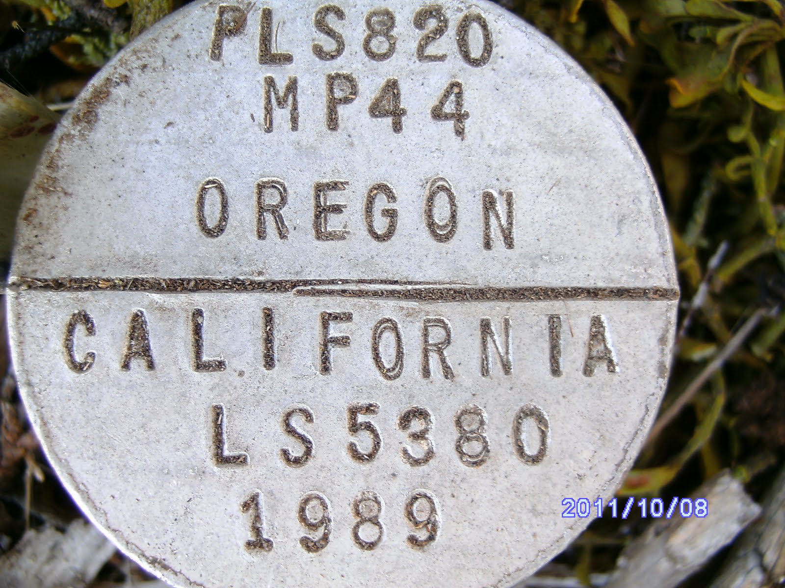
The ride back to the truck was great as it had warmed up and the flat, well packed cinder and dirt roads made for some fun full throttle stretches. Never did see any hunters while hiking, but we passed a couple of guys trolling along the road with their quads that were clearly surprised to see us overtake them. Drove back to the truck in about 30 minutes, took a quick break and then headed on to the east with the bikes along Corral Creek road which parallels the state line before dropping south and then into the Goose Lake basin. We ran on down to about 32 where the road leaves the state line and wanders more to the south skirting the cliffs bordering the Renner Lake valley.
Legs 16: Oct 2011 Langell Valley
Well, I suppose 23 plus miles over 2 and half days isn’t bad. Although we hoped for more, my Magellan 500 GPS gave up the ghost sometime late Saturday night and I still haven’t gotten it to work. Finally had it tuneed in and working fine Friday and all day Sat, but I left it on overnight and Sunday it was locked up. Removed the card, batteries etc but wouldn’t “boot up” again. Tried it at home and looks like the thing’s scrambled and I lost the data from Fri and Sat.
Leg 16. Dwane and I headed down early Friday, not as early as we’d liked, but it turned out OK. Dwane came down Thursday and we attended the Oregon – Cal football game that evening. Did I mention the Ducks thrashed the Bears! I had loaded up everything the previous weekend, so the next morning we got an early stop, topped off with fuel and munchies and headed towards Klamath Falls intending to fill in some of the gap between Lakeview (Goose Lake) and Malin. We got a few supplies in town after the 3 hour drive down and then headed east out into the Langell Valley area along the newly operational natural gas pipeline. Managed to make one wrong turn and headed back towards Malin instead of SE as desired, but after a quick turnaround we only wasted a about 10 miles of out of direction driving. Would have liked to be able to blame Dwane, but alas, I was driving and not paying attention to the intersections. The pipeline carries natural gas from Wyoming all the way to Malin where it plugs into the major west coast distribution system. Those cowboys will be able to pass their gas on to California now! We’d hiked a few segments back along their right of way and it was neat to see how they’d finished up the 100 yard swath they cut through the southern width of the state. The BLM made them sort rocks, save woody debris and whole trees, and then re-landscape the whole right of way with the rocks and down trees.
Here's a milepoint burried in a squirrel/rat nest. We found several like this where they had mounds of rock covered with woody debris.

Most of the country was wooded with open areas such as this and we walked along fence line for perhaps 70% of the way.

We planned to knock out 4 or 5 miles in the afternoon backing up east from about mile post 50 where we had jumped to from east of Goose Lake to leave this gap. This leap froging our vehicles eastward while walking west seems to be the best routine we’ve found. We can break the hikes into more predictable segments for time and effort. We unloaded the mini-bikes a couple hundred yards away from the road and pipeline right of way at mile point 50+, locked up the truck and headed west with the bikes to an area called upper Willow Creek along the border near 45. Saw a few hunters, it was opening weekend for “fire sticks”, and helped orient a lost pair of Forest Service folks and then found a spot in the trees a hundred yards off a side road to stash the bikes near 45. We started back along the state line headed west thru the pine forest, open meadows, a couple of irrigated pastures, and several lava rock strewn meadows. I’d made a major re-boot of the GPS over the last couple of months and had reloaded the mile point data provided by the BLM and everything seemed to be working great for once. Got good readings for the mile points, created a waypoint for each and took a close up and step back picture with the camera. Camera was working fine also, so we were upbeat. Beautiful weather, sunny but cool, and some of the nicest forest we’d walked thru to-date. The couple of pasture areas we traversed were wet, but my feet dried out pretty quickly and I didn’t even change socks. Still wearing my Merril shoes – I’ve made the whole trip with the same pair so far and they are wearing great. Hoping to become a poster boy for Merril Shoes when we reach the ocean and complete the trip.

We got back to the truck in a couple of long hours and headed east past the bikes along a fairly parallel road network to find a place to sleep overnight about 10 miles further back along the line.


By the time we checked out a couple of potential intersect points it was getting dark. We passed a couple of different hunter’s camps as we looked for another spot to overnight in the camper and settled on a spot near an intersection at about 38. Found a cleared area a hundred yards off the intersecting road and threaded our way in the dark thru some down trees and branches with the truck. Chowed down on some nutri-type bars and a couple of bagels for dinner and crawled into our bags for the night.
Thursday, May 26, 2011
The Glass House mystery solved
Got this info from a blog reader familiar with the history of the glass house referred to in our Sheldon 7th Leg post.
From allan_e@efn.org
I read your blog post on going to Crump Lake and visiting the Glass House by the Narrows.
The house was built by Walt Benson, a wine grape grower from CA. I did some of the work on the house while living at The Nature Conservancy's Crump Lake Preserve (the abandoned ranch 1/ mile south of Fisher Hot
Springs) in 1992 - '93. There is a solar well located down near the gate.
Last I had heard Walt was trying to sell the place.
The old homestead just west of Walt's place is the original valley homestead and is on TNC property. Locals were disappointed w/ their entire TNC experience (I was the good part of their experience). They were especially miffed that TNC was letting the homestead fall apart.
Living at Crump Lake was one of the best experiences of my life. A quiet unmatched in my experience.
Saturday, May 7, 2011
Klamath Basin - Leg 15
Next day we did the Klamath Basin – about 20 miles along roads and canal levees across the southern part of the valley from Malin to Hwy 97. Couple of small ridges, otherwise nothing but trudging on while marveling at the pelicans, hawks, and multitude of other birds like the two below we came on when nearing the last 5 miles or so before Hwy 97. The birds were really neat, but open, dusty, walking without much terrain to marvel at was the rule for this 20 miles.

If you look closely, you'll see three different surveyed monuments in the picture below.


If you look closely, you'll see three different surveyed monuments in the picture below.

We found several of the earlier mile point monuments protected with a larger diameter pipe driven in later to encase them such as below.
 Mile point 83 from 1952.

One of the older Mile points, # 82 dating from 1919.

The whole border is north of the 42d through here. This is looking back straight down the line towards Malin about 6 miles out.
 You can see the scar of the pipeline in the distance coming down the western slope towards Malin. Below, Mt Shasta loomed in the distance from its California perch.

Looking back to the east towards Malin about 12 miles distance. Most of our walking was along the canals. There were plenty of side roads and berms, so we were able to avoid any muddy places or having to cross water.


The only rough going was a few hundred yards of tumble weeds and brush to navigate a couple miles short of Hwy 97. The wayside on 97 is at the base of the hill in the distance here. We had a flooded field to slog through on the other side of this brushy part.
The Malin ridge in the far distance looking back east as we climbed out of the basin the last half mile back to the wayside along Hwy 97.

The last mile got a little “damp” and muddy, but the end was in sight.
All in all, tiring, but a lot of miles and beautiful country. Sure would like to know who the folks up Hidden Valley Road are however so we can certainly cross them off our Christmas list.
 Mile point 83 from 1952.
One of the older Mile points, # 82 dating from 1919.

The whole border is north of the 42d through here. This is looking back straight down the line towards Malin about 6 miles out.
 You can see the scar of the pipeline in the distance coming down the western slope towards Malin. Below, Mt Shasta loomed in the distance from its California perch.
Looking back to the east towards Malin about 12 miles distance. Most of our walking was along the canals. There were plenty of side roads and berms, so we were able to avoid any muddy places or having to cross water.


The only rough going was a few hundred yards of tumble weeds and brush to navigate a couple miles short of Hwy 97. The wayside on 97 is at the base of the hill in the distance here. We had a flooded field to slog through on the other side of this brushy part.
The Malin ridge in the far distance looking back east as we climbed out of the basin the last half mile back to the wayside along Hwy 97.

The last mile got a little “damp” and muddy, but the end was in sight.
All in all, tiring, but a lot of miles and beautiful country. Sure would like to know who the folks up Hidden Valley Road are however so we can certainly cross them off our Christmas list.
We'll likely go to the Lakeview area next time out and work west to near Willow Valley Res. Probably avoid doing the other side of the Klamath River canyon until fall - it has a well deserved reputation for being "snaky" and although we only saw a single garter snake in one of the meadows, the sun was out and plenty of lizards (skinks) were out. We've now covered 225 miles of the 375 mile long border by my calculations, so it's down hill from here, figuratively and literally except for the two 5 mile mountain tops we skipped each side of Denio.
Subscribe to:
Posts (Atom)