

The mile points were pretty darn close and most of them came from and 1939 survey. I think I’ve finally figured out my GPS and should be able to get waypoints from here on that should be of interest to our geographic sciences branch in the BLM as we get further west. Was a pretty uneventful day, lots of flat walking with one 2 mile stretch across a broad sagebrush plateau with hunters kicking up dust all around in their 4X4s while scanning for deer. We wore bright colors of course that day. Dave caught us a couple mile before the end of our planned distance and we took a short break before heading off to the brink of the Coleman Valley. Traversed through some more old juniper trees as we came to the edge of the bluff.
 Covered a couple of miles of this old growth juniper forests. These things grow to be several hundred years old, yet are rarely more than 20 feet tall.
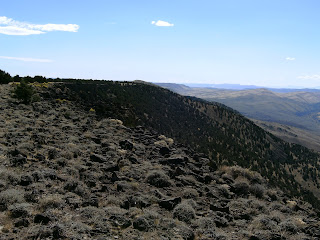
Heck of a drop with the first hundred feet or more being vertical. We scouted out a path to the south about a 1.4 mile where it looked like we could clamber down the rocks and then slip and slide down the forested, but steep dirt slope to the valley floor. Was so steep it looked like only a few hundred horizontal yards separated us from the valley floor along Coleman road, but it was actually near two miles. We dropped a 1000 feet in that space down through the juniper and as we neared the bottom increasingly boulder strewn sagebrush.
Here we are after 7-8 miles across the juniper and one flat basin standing with our backs to the cliff overlooking the Coleman Valley. Had about 100 foot cliff to deal with so we detoured south along the rim till we could find a way down to the juniper and grass slope.

View from a quarter mile south looking back at the point where we were both standing. This is where we found a fairly safe way down off the rim rock.

Huge dust devil probably 8 miles away on the dry lake bed to the north.

View from a quarter mile south looking back at the point where we were both standing. This is where we found a fairly safe way down off the rim rock.

Huge dust devil probably 8 miles away on the dry lake bed to the north.
Picture from 300 to 400 feet down the slope thru the junipers. Looking back up at the overlook point on the rim.


No comments:
Post a Comment